UK weather: Met Office warns of thunderstorms and heavy rain drenching Britain – just days after 23C sunshine
THUNDERSTORMS and heavy downpours are set to drench the UK in coming days – but not before Brits bask in some 23C sunshine.
Much of the country soaked in the rays over the Bank Holiday weekend, with crowds flocking to beaches.

4

4

4

4
And this week is set to be mostly dry, with sunny spells and warmer temperatures.
The mercury is forecast to be in the high teens, early 20s for much of the south during the days this week.
It’s set to rise to a balmy 23C in London on Saturday.
The Met Office said parts of the UK may be hit with rain, but it’s mostly dry.
Looking at tomorrow, forecasters said: “Mist, fog and coastal low cloud soon clearing to leave another dry day with sunny spells.
“Outbreaks of rain and stronger winds reaching the far north and northwest later.”
And looking from Thursday to Saturday, the Met said: “Largely fine and dry with variable amounts of cloud and some sunshine.
“Outbreaks of rain affecting the north and northwest at times. Feeling increasingly warm.”
But, the taste of summer isn’t looking to hang around for long.
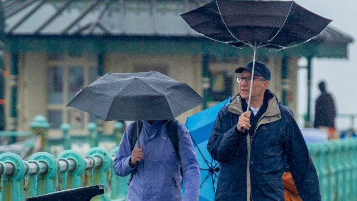
The Met Office says the country is set to be hit with heavy rain and thunderstorms.
In its long-range forecast, from Saturday, it says: “Following this spell of pleasant May weather though, it’s all change the following week with conditions likely to turn more changeable across the country, with rainfall likely to be above average in most areas.
“Some of the rain is likely to be heavy and a few thunderstorms are also likely.”
At the weekend the shining in different parts of the country, seeing the masses rush outdoors to make the most of it.
Beaches like Brighton were packed with people who wanted to get near the sea on Sunday while the temperatures were warm.
Miss Lancashire Amy Blyth, 22, even donned her bikini in Coventry while the sun was out.
And it was all blue skies in Sheerness, Kent for the Blaze class sailing dinghy Eastern Championships event hosted by Isle of Sheppey Sailing Club.
But the weather was constantly changing – with downpours drenching Brits yesterday and the Met Office issuing “danger to life” warnings.
It said the yellow warnings called for power cuts due to lightning strikes with homes and businesses facing imminent floods.
The Met Office said: “There is a small chance of fast flowing or deep floodwater causing danger to life.”
Met Office’s five-day & long-range forecast:
Today:
A cloudy start with mist and fog clearing through the morning and sunny spells developing for most, away from parts of Scotland and northern England. Dry for many although a few showers will develop. Feeling warm in the sunshine.
Tonight:
Evening showers soon fading leaving a generally dry night with clear spells. Low cloud spreading in from the North Sea and some mist and fog in the south and west.
Wednesday:
Mist, fog and coastal low cloud soon clearing to leave another dry day with sunny spells. Outbreaks of rain and stronger winds reaching the far north and northwest later.
Outlook for Thursday to Saturday:
Largely fine and dry with variable amounts of cloud and some sunshine. Outbreaks of rain affecting the north and northwest at times. Feeling increasingly warm.
Saturday May 11 – Monday May 20:
The coming weekend will probably remain fine for many, with some spells of sunshine for most and it will continue to feel warm, especially in parts of the south and east where temperatures are likely to remain in the mid-20’s. Some areas of cloud are likely, especially around some coasts and perhaps later in northwest Scotland, with an increasing risk of a few showers here too. Following this spell of pleasant May weather though, it’s all change the following week with conditions likely to turn more changeable across the country, with rainfall likely to be above average in most areas. Some of the rain is likely to be heavy and a few thunderstorms are also likely. Temperatures will return back closer to normal for May.
Tuesday May 21 – Tuesday June 4:
For the end of May and the start of June, it will probably start off fairly unsettled with rain or showers for many, but also some sunny spells between them, and slightly-above average temperatures. Through the period there are some signs that conditions could become a little more settled in the south and east, with most of the rain reserved for the north and west. With a strong sun at this time of year, it will feel warm in any sunshine.
>